List of References

References for MSS and MilX Online-Articles

The information displayed in the context of MSS / MilX / MssStick is on principle free invented or publicly accessible.


1. Publicly available on the internet:

For this purpose, the information available on the following websites/domains were used:

  • http://www.vtg.admin.ch/internet/...
  • http://www.he.admin.ch/internet/heer/...
  • http://www.lba.admin.ch/...
  • http://iofapp.ch/...


2. Publicly available regulations and journals:

For this purpose, the following regulations and journals were used.


Journals:

  • ASZM
  • Schweizer Soldat


Regulations:

  • OF XXI
  • TF-XXI
  • FSO XXI
  • Regl. 52.002 / 52.003 / 52.15 /...
  • Regl. 54.001


3 Military Map Overlays

All layers/images which are not covered by point 1 or 2 are invented and manually created by gs-soft. This can be discovered by the intended tactical errors on the layers (looks great, but doesn't make sense).

MssStick, MSS and MilX

MssStick, MSS and MilX

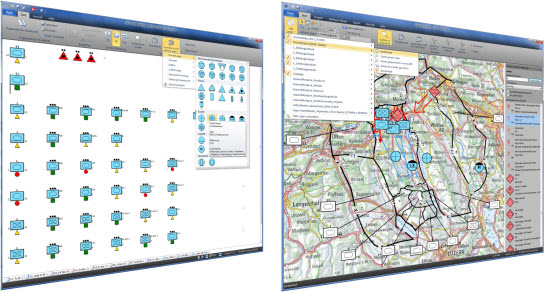
This product family is the solution for fast, simple and flexible creation and exchange of military map overlays, status reports of units and organization structures in an electronic system.


Background

During our more than twenty years of developing applications for the Swiss Armed Forces we have seen management systems becoming increasingly complex, making it more and more difficult to understand for the users. This is in contrast with the fact that today that less time is available to educate troops on a system.


This motivated us to design a simple and flexible solution with the focus on specific troops in the Swiss Armed Forces, as well as third parties such as police, civil protection, or the media.


What is our solution?

Our solution includes three parts:

The components MssStick, MSS and MilX


The first component, MSS (Military Symbol Service), is responsible for the visualization of military map overlays by using existing national and international standards for symbols and tactical graphics.

The second component, MilX (Military Exchange Service), defines the Exchange. MilX is a very powerful and yet easy format for exchanging information between different command systems.

The third component, MssStick, is the application which can be used if no other system is available or ready for use.


Where can I get more information?

For more information about all of these components, visit this website. If you have any questions regarding MilX, MssStick, MSS, do not hesitate to contact us.


MssStick

MssStick

The MssStick is our "ready to run" solution to create and manage military map overlays, to design military reference grid systems as well as to organize military structures and resources. An easy share and exchange between the partners in the military workflow is included as well.


What is the MssStick?

The "ready to run" environment includes two main applications:

MssDraw to generate military map layer
MssComposer to generate organizations

This tool has been designed to be very flexible and operational within minutes. There is no installation required to start the application. Nor is a long preparation phase needed as commonly known from a larger and heavier C4I system.

Our main goal of the MssStick is to accelerate the operational planning phase over multiple hierarchies as well as enabling the work between different organizations as Armed Forces, Police, Civil Defense and the Media.

Creation of Military Maps and ORBATS


How does it work?

Plug the MssStick into your computer and start the application. There is no installation required. Create your exchange operational pictures, ORBATS and equipment lists. Share your results with other MssStick users or C4I systems having MSS and MilX implemented.

The exchanged files are very small in size due to the use of the MilX-technology and can be exchanged even via low bandwidth connections.

Where can I get more information?

Don’t hesitate to contact us if you have any question regarding the MssStick. More information can also be found in our News-Section.

is to accelerate the operational planning phase over multiple hierarchies as well as enabling the work between different organizations as Armed Forces, Police, Civil Defense and the Media.

MSS - The Military Symbol Service

MSS®

The Military Symbol Service.


 What is MSS?

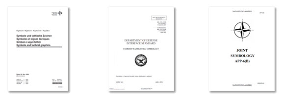
MSS (Military Symbol Service) is a very powerful, compact and complete library of military symbols and tactical graphics. The library itself contains today more than 3500 symbols and tactical graphics which are defined in the following national and international regulations:

NATO

APP-6(B) and MIL-STD-2525C

Swiss Armed Forces

Regl. 52.002.03/04

Police

Führung im Polizeieinsatz

Traffic Regulations

Regl V+T and TCS: Strassensignale


MSS includes the following Standards


Who is using MSS today?

MSS is implemented in a number of systems by the following suppliers: TADIRAN, EADS, THALES, AMPER, ELTA, ELCA ... . It is nationally used by the Swiss Armed Forces and internationally by NATO (JC3IEDM / MIP) as the symbol and tactical graphic provider.
 

What is the advantage of MSS?

Symbols or tactical graphics are not exchanged as images; they are handled via their SymbolString. This enables the system independent exchange of graphics within only a few characters. The MSS library which contains all symbols and tactical graphics can be extended with country and/or product specific graphics. This includes as well the display options and settings.
The service can be implemented in any system requiring military symbols and tactical graphics. It provides a wide range of export formats including,*.svg, *.png, *.wmf, *.emf, *.jpg, *.bmp, ...


Where can I get more information?

Don’t hesitate to contact us if you have any question regarding MSS. More information can also be found on the MssStick page as this application runs with the latest version of MSS.

Symbol fill options

MilX – The Common Military Exchange Format

MilX®

The format for a light, fast and flexible exchange.


What is MilX?

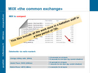
It’s the common military exchange format. It enables the exchange of military map overlays created with the use of MSS. In addition it is possible to exchange ORBATS including status and material lists with the use of MilX. MilX therefore provides the possibility to exchange all this data with other command and control systems within Armed Forces.

MilX 'the common exchange format'


What is the advantage of MilX?

It provides the light, fast and flexible exchange between different systems. This is especially targeted to
provide an exchange which doesn’t require much data and therefore is possible via a simple radio connection.
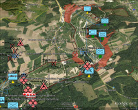
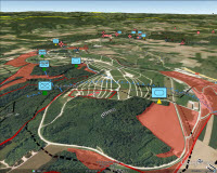
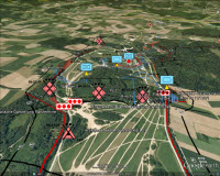
Additionally it’s possible to export a MilX-Layer into GoogleEarth. As the following images show:
 

Military Symbology on GoogleEarth

Military Symbology on GoogleEarth

Military Map Overlay


Who is using MilX?

Today companies as THALES, ELBIT, Airbus, ELCA... have implemented MilX in some of their military systems.

How to embed map.army in a web page

The web application map.army can be integrated into a web page with just a few lines of code. The following article shows the necessary steps.


Embed using iFrame

The integration of the web application into a web page can be done via an iFrame. The following sample code displays map.army with all its functions in an 800 pixel wide and 600 pixel high frame. The definition for the attributes supported in the iFrame such as height, width, border, ... can be found here.

<iframe src="https://www.map.army " width="800" height="600" frameborder="0"></iframe>


Hint: Is the iFrame running in a local HTML file, but not on your website? In this case, it is important to ensure that the web server or the CMS support iFrames. In most CMS, this is a parameter that needs to be enabled.


Load MilX-Layer using URL parameter

The latest version of the web application supports to load military map overlays as a ULR parameter. This enables the implementation of an interactive maps into a web page or blog:

 The following steps are required for the implementation:


Step 1 – Save Map Overlay(s)

Create your layers in the web application map.army. Save one or multiple overlays into a single MilX file (layer collection). 


Step 2 – Upload

Load the MilX file created in step 1 on your web server. Test whether the layer can be downloaded as a file using a web browser. Example of a link to a layer: www.gs-soft.com/CMS/files/Layer.milxlyz
If you are not able to download the file: Check whether the web server supports the MilX file format (MIME Type):
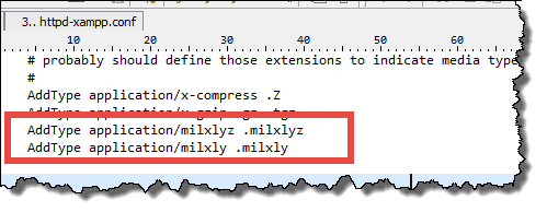
Apache MIME Type Definition
Example of MIME Type definition for *.milxlyz and *.milxly.


Step 3 - Cross-Origin Resource Sharing (CORS)

Is your web server supporting CORS? This is required for the MilX files on your web server to be loaded by a web browser running the web application on www.map.army. CORS therefore must be activated for the domain www.map.army. Depending on the web server this can be done by the following steps:


Apache: The *.htaccess file (in the folder on the web server that contains the *.milxlyz file) should be extended with the following permission:
Apache CORS activation in *.htaccess

Header add Access-Control-Allow-Origin: https://www.map.army

Note: If there is no *.htaccess file in this folder, it must be generated and the permission listed above has to be integrated.


IIS: The following customization has to be made in the IIS GUI:
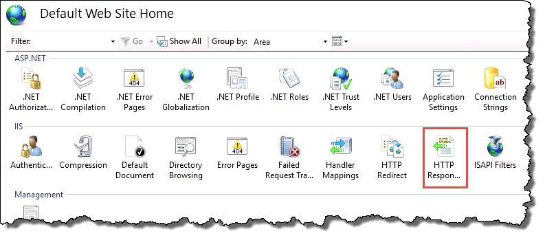
IIS CORS activation - step 1 IIS CORS activation - step 2

As an alternative, the following permission can allow CORS using the web.config file (in the folder containing the *.milxlyz file):
IIS CORS activation via web.config

<?xml version="1.0" encoding="UTF-8"?>  
  <configuration>  
      <system.webServer>  
          <staticContent>  
              <mimeMap fileExtension=".milxlyz" mimeType="application/octet-stream" />  
          </staticContent>  
          <httpProtocol>  
              <customHeaders>  
                  <add name="Access-Control-Allow-Origin" value="     
    https://www.map.army" />
                </customHeaders>  
          </httpProtocol>  
      </system.webServer>  
  </configuration>


Step 4 - Test

Is it possible to load a military map overlay (layer) directly from the web server in www.map.army using the URL parameters? To test this, you can replace the URL of the MilX layer (www.gs-soft.com/CMS/files/Layer.milxlyz) in the following example: https://www.map.army/?layer=www.gs-soft.com/CMS/files/Layer.milxlyz


Step 5 - Read-Only Parameter

Depending on the application the layers loaded via the URL parameter should be editable or not. For this purpose, the "readonly" parameter is provided. It can be attached to the URL as the following example demonstrates:

https://www.map.army/?layer=www.gs-soft.com/CMS/files/Layer.milxlyz;readonly


Step 6 - Adjust iFrame

After completing steps 1 - 5 your are able to add the URL parameters to the iFrame on your web page. Here is an example of code that you can copy:

Example 1:

<iframe src="https://www.map.army/?layer=www.gs-soft.com/CMS/files/Layer.milxlyz;readonly"  
width="800" height="600" frameborder="0" style="border:0"></iframe>  

Example 2:

<iframe src="https://www.map.army/?layer=www.gs-soft.com/CMS/files/Demo-Layers.milxlyz;readonly"   
width="100%" height="98%" frameborder="0"></iframe>

 
If you have further questions, we are happy to assist you in our Google Group.
www.map.army is now online

'MilitaryMap' is the first web application to visualize and plan military exercises and missions. It provides functions to draw, save, export and exchange military map overlays.The App is designed to be used on a desktop, notebook, tablet or even a touch screen mobile phone. The entire App as well as the military symbology web service used in the back has been developed by gs-soft AG.

www.map.army is now online

Dynamic creation of documentations using MSS

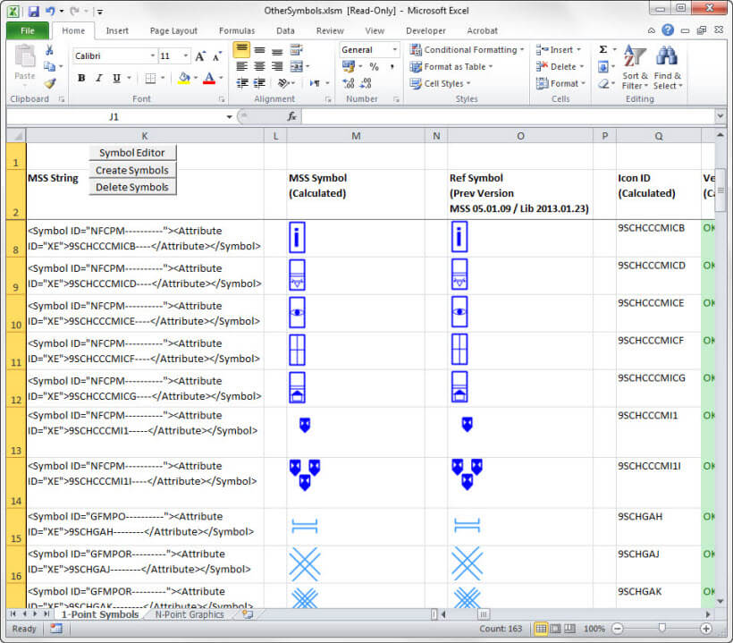
MSS ExcelControlSheet
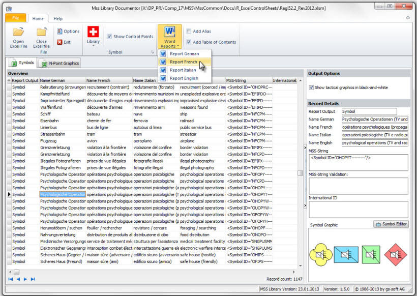
MssDocumentor with loaded ExcelControlSheet
MssDocumentor Output Document
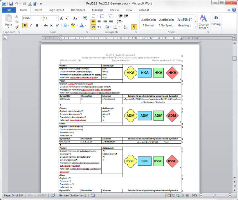
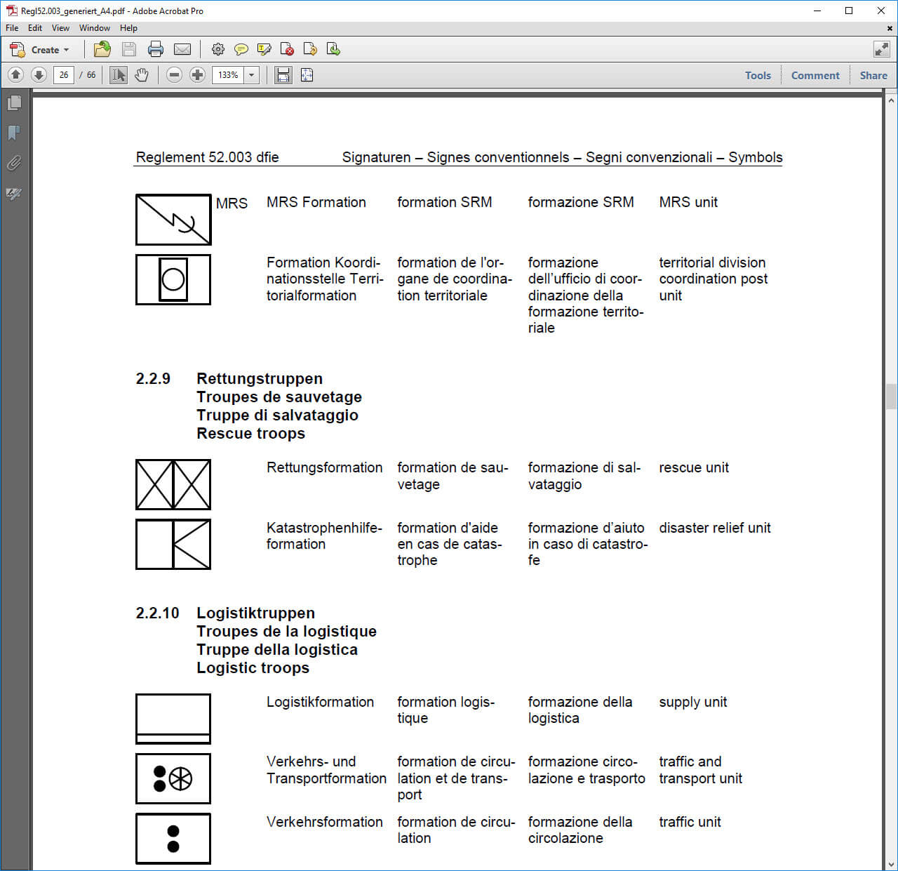
MssDocumentor Generates Regulation 52.003

MssDocumentor is our application for the dynamic generation of complete military symbology regulations or standards. It has been developed by the same team that successfully created MIR GEN which is used today by NATO (Military Interoperability Program) to create the symbology mapping definitions.

How does MssDocumentor work?
It starts with a database or an Excel document. This base document contains the structure of the standard and includes the definition of the chapters in the standard as well as the symbol IDs. 

  • In a first step this base definition is loaded into the MssDocumentor. During the import process the data is validated.
  • The rendering options as "line width", "color selection", "symbol representation" etc. are set in a second step. In addition, options as output format and language (English, French, German, Italian) can be set.
  • In the third step it has to be defined how tactical graphics (N-Point Symbols) are represented. It is possible to choose between corridor or non-corridor representation. In addition it is possible to display or hide the reference points used to generate the tactical graphic. 
  • The generation of the document can be started with one click after setting the definitions in step one to three. 

It has never been simpler to generate and maintain symbology regulations then with MssDocumentor. 

Military Symbol as SVG

How can military symbols created on symbol.army be transferred to an application as Inkscape?

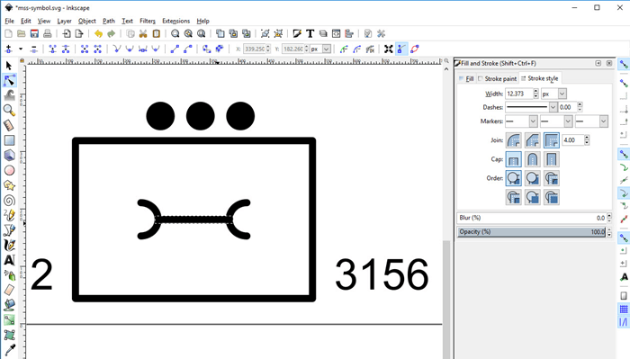
This is very simple! The best way to import a military symbol into Inkscape is by using a vector format. symbol.army supports SVG or XAML image formats. The following steps are required to transfer a symbol:


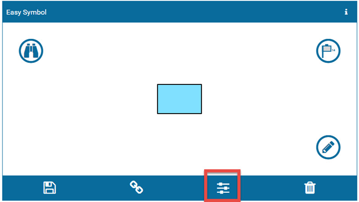
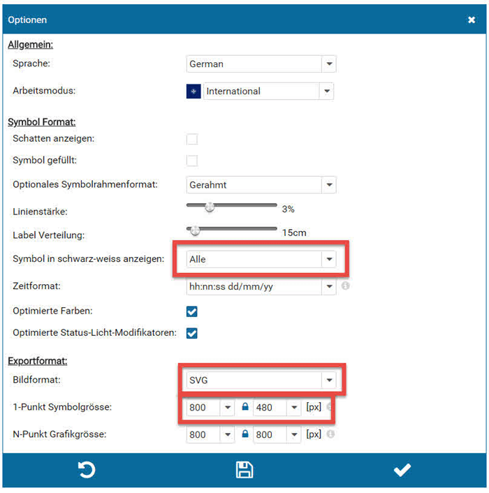
Open the ‘Optionen’ Window in symbol.army
Set Work Mode of the Symbol Library and the Language
Set the Symbol Format Options in symbol.army

Step 1: Set the Options in symbol.army
The language should be changed/set to English and the International working mode should be selected. In a second step the format options such as line width, image format, ... shall be defined.

Step 2: Create Military Symbol
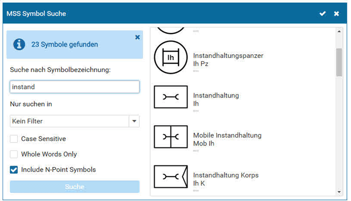
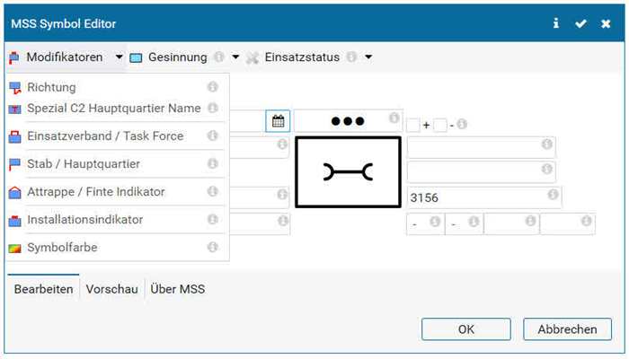
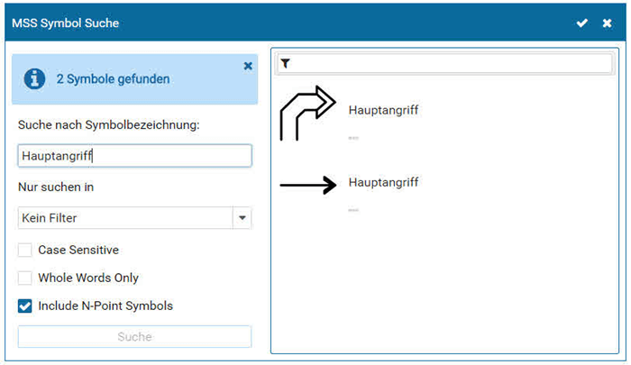
The base symbol can be found and selected with the help of the ‘Search’ dialog in the web application. The modifiers and attributes of the military symbol can be defined in the ‘MSS Symbol Editor’. This editor provides the available modifiers and attributes according to the international symbology standards MIL-STD-2525 and APP-6.


Search in Military Symbology Library
Add, Change or Remove Modifiers and Attributes of the Military Symbol
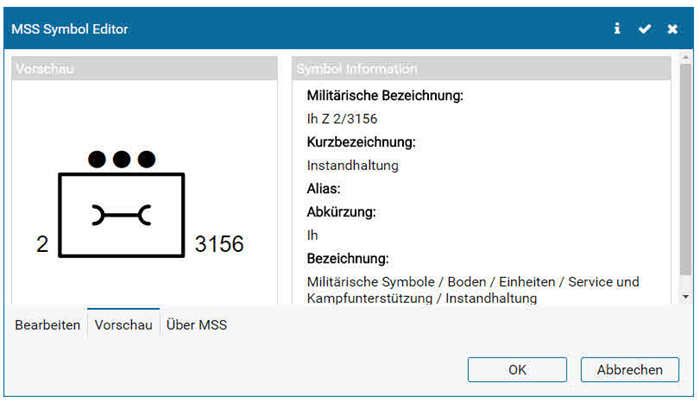
Check Created Military Symbol in the Preview Window

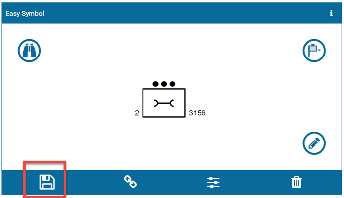
Save Military Symbol as SVG

Step 3: Save Military Symbol as SVG
The generated military symbol can now be stored as SVG. If the picture is not saved in the correct format or the image is too small --> check again the ‘Options’ in the symbol.army.

Step 4: Open and Edit Military Symbol in Inkscape
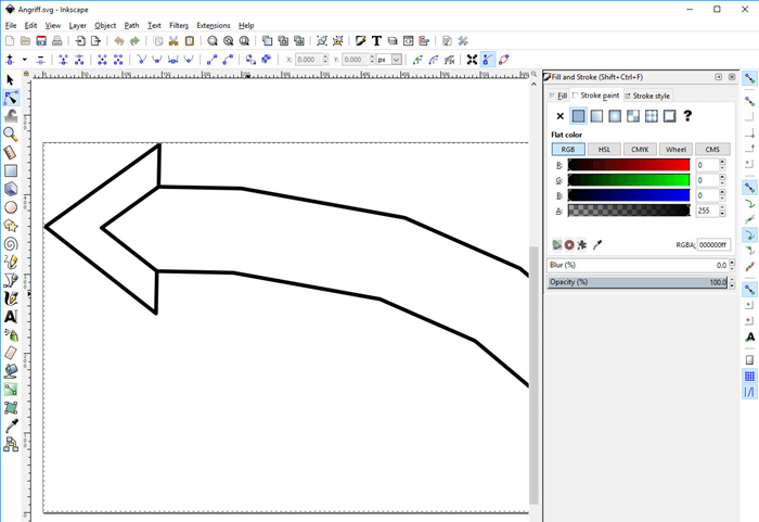
The image saved as SVG can be opened directly in Inkscape or any graphics program that supports the image format. The individual elements of the tactical graphic can now be edited.


Open and Edit the Military Symbol generated on symbol.army in Inkscape
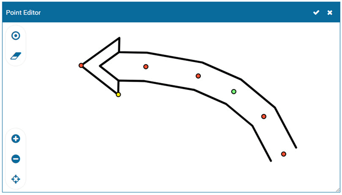
Search for Military N-Point Symbol (Tactical Graphic)
Edit Military Symbol and Save as SVG
Open and Edit the N-Point Military Symbol in Inkscape

Hint: Editing Tactical Graphics (N-Point Symbol) such as a phase lines or displacement axis is supported as well.

Contact US

  • gs-soft AG

    Delfterstrasse 10

    CH-5000 Aarau

    Switzerland

    Phone:
    +41 62 832 20 40
    E-Mail:
    This email address is being protected from spambots. You need JavaScript enabled to view it.


  • Language