How to embed map.army in a web page

The web application map.army can be integrated into a web page with just a few lines of code. The following article shows the necessary steps.


Embed using iFrame

The integration of the web application into a web page can be done via an iFrame. The following sample code displays map.army with all its functions in an 800 pixel wide and 600 pixel high frame. The definition for the attributes supported in the iFrame such as height, width, border, ... can be found here.

<iframe src="https://www.map.army " width="800" height="600" frameborder="0"></iframe>


Hint: Is the iFrame running in a local HTML file, but not on your website? In this case, it is important to ensure that the web server or the CMS support iFrames. In most CMS, this is a parameter that needs to be enabled.


Load MilX-Layer using URL parameter

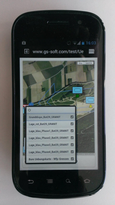
The latest version of the web application supports to load military map overlays as a ULR parameter. This enables the implementation of an interactive maps into a web page or blog:

 The following steps are required for the implementation:


Step 1 – Save Map Overlay(s)

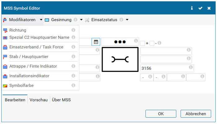
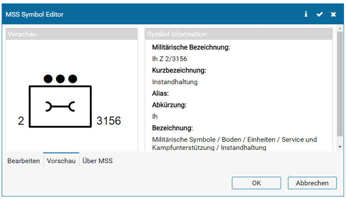
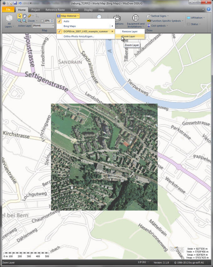
Create your layers in the web application map.army. Save one or multiple overlays into a single MilX file (layer collection). 


Step 2 – Upload

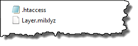
Load the MilX file created in step 1 on your web server. Test whether the layer can be downloaded as a file using a web browser. Example of a link to a layer: www.gs-soft.com/CMS/files/Layer.milxlyz
If you are not able to download the file: Check whether the web server supports the MilX file format (MIME Type):

Apache MIME Type Definition
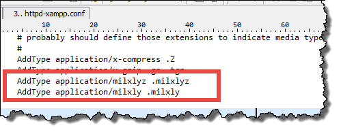
Example of MIME Type definition for *.milxlyz and *.milxly.


Step 3 - Cross-Origin Resource Sharing (CORS)

Is your web server supporting CORS? This is required for the MilX files on your web server to be loaded by a web browser running the web application on www.map.army. CORS therefore must be activated for the domain www.map.army. Depending on the web server this can be done by the following steps:


Apache: The *.htaccess file (in the folder on the web server that contains the *.milxlyz file) should be extended with the following permission:
Apache CORS activation in *.htaccess

Header add Access-Control-Allow-Origin: https://www.map.army

Note: If there is no *.htaccess file in this folder, it must be generated and the permission listed above has to be integrated.


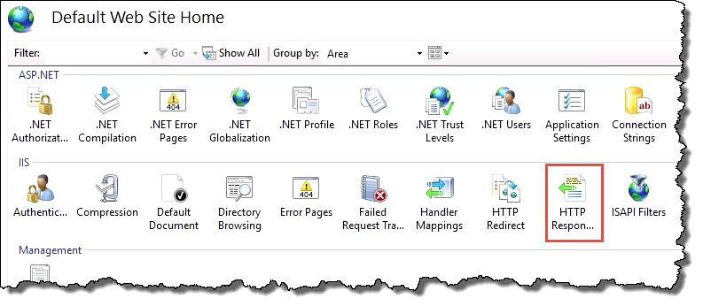
IIS: The following customization has to be made in the IIS GUI:
IIS CORS activation - step 1 IIS CORS activation - step 2

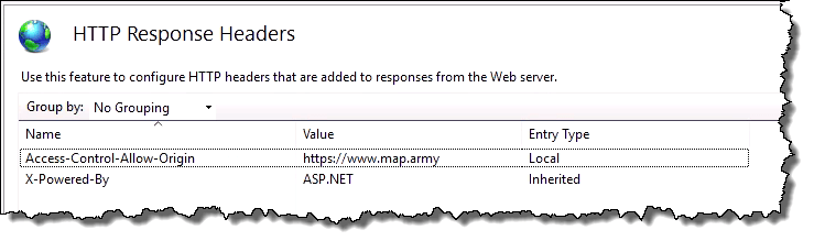
As an alternative, the following permission can allow CORS using the web.config file (in the folder containing the *.milxlyz file):
IIS CORS activation via web.config

<?xml version="1.0" encoding="UTF-8"?>  
  <configuration>  
      <system.webServer>  
          <staticContent>  
              <mimeMap fileExtension=".milxlyz" mimeType="application/octet-stream" />  
          </staticContent>  
          <httpProtocol>  
              <customHeaders>  
                  <add name="Access-Control-Allow-Origin" value="     
    https://www.map.army" />
                </customHeaders>  
          </httpProtocol>  
      </system.webServer>  
  </configuration>


Step 4 - Test

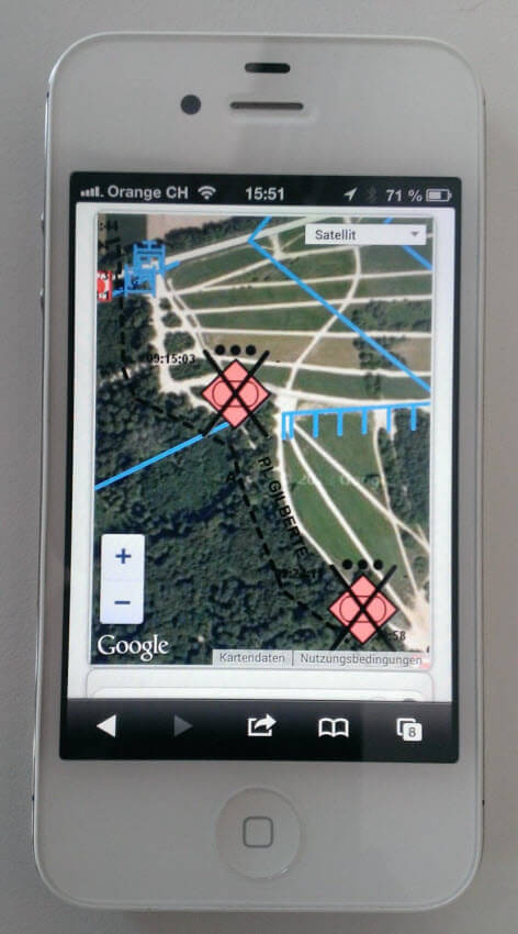
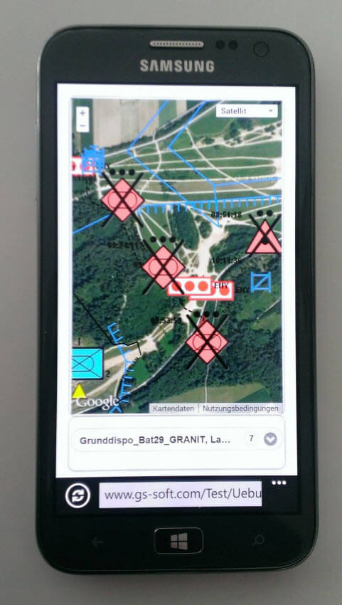
Is it possible to load a military map overlay (layer) directly from the web server in www.map.army using the URL parameters? To test this, you can replace the URL of the MilX layer (www.gs-soft.com/CMS/files/Layer.milxlyz) in the following example: https://www.map.army/?layer=www.gs-soft.com/CMS/files/Layer.milxlyz


Step 5 - Read-Only Parameter

Depending on the application the layers loaded via the URL parameter should be editable or not. For this purpose, the "readonly" parameter is provided. It can be attached to the URL as the following example demonstrates:

https://www.map.army/?layer=www.gs-soft.com/CMS/files/Layer.milxlyz;readonly


Step 6 - Adjust iFrame

After completing steps 1 - 5 your are able to add the URL parameters to the iFrame on your web page. Here is an example of code that you can copy:

Example 1:

<iframe src="https://www.map.army/?layer=www.gs-soft.com/CMS/files/Layer.milxlyz;readonly"  
width="800" height="600" frameborder="0" style="border:0"></iframe>  

Example 2:

<iframe src="https://www.map.army/?layer=www.gs-soft.com/CMS/files/Demo-Layers.milxlyz;readonly"   
width="100%" height="98%" frameborder="0"></iframe>

 
If you have further questions, we are happy to assist you in our Google Group.

www.map.army is now online

'MilitaryMap' is the first web application to visualize and plan military exercises and missions. It provides functions to draw, save, export and exchange military map overlays.The App is designed to be used on a desktop, notebook, tablet or even a touch screen mobile phone. The entire App as well as the military symbology web service used in the back has been developed by gs-soft AG.

www.map.army is now online

Dynamic creation of documentations using MSS

MSS ExcelControlSheet
MssDocumentor with loaded ExcelControlSheet
MssDocumentor Output Document
MssDocumentor Generates Regulation 52.003

MssDocumentor is our application for the dynamic generation of complete military symbology regulations or standards. It has been developed by the same team that successfully created MIR GEN which is used today by NATO (Military Interoperability Program) to create the symbology mapping definitions.

How does MssDocumentor work?
It starts with a database or an Excel document. This base document contains the structure of the standard and includes the definition of the chapters in the standard as well as the symbol IDs. 

  • In a first step this base definition is loaded into the MssDocumentor. During the import process the data is validated.
  • The rendering options as "line width", "color selection", "symbol representation" etc. are set in a second step. In addition, options as output format and language (English, French, German, Italian) can be set.
  • In the third step it has to be defined how tactical graphics (N-Point Symbols) are represented. It is possible to choose between corridor or non-corridor representation. In addition it is possible to display or hide the reference points used to generate the tactical graphic. 
  • The generation of the document can be started with one click after setting the definitions in step one to three. 

It has never been simpler to generate and maintain symbology regulations then with MssDocumentor. 

Military Symbol as SVG

How can military symbols created on symbol.army be transferred to an application as Inkscape?

This is very simple! The best way to import a military symbol into Inkscape is by using a vector format. symbol.army supports SVG or XAML image formats. The following steps are required to transfer a symbol:


Open the ‘Optionen’ Window in symbol.army
Set Work Mode of the Symbol Library and the Language
Set the Symbol Format Options in symbol.army

Step 1: Set the Options in symbol.army
The language should be changed/set to English and the International working mode should be selected. In a second step the format options such as line width, image format, ... shall be defined.

Step 2: Create Military Symbol
The base symbol can be found and selected with the help of the ‘Search’ dialog in the web application. The modifiers and attributes of the military symbol can be defined in the ‘MSS Symbol Editor’. This editor provides the available modifiers and attributes according to the international symbology standards MIL-STD-2525 and APP-6.


Search in Military Symbology Library
Add, Change or Remove Modifiers and Attributes of the Military Symbol
Check Created Military Symbol in the Preview Window

Save Military Symbol as SVG

Step 3: Save Military Symbol as SVG
The generated military symbol can now be stored as SVG. If the picture is not saved in the correct format or the image is too small --> check again the ‘Options’ in the symbol.army.

Step 4: Open and Edit Military Symbol in Inkscape
The image saved as SVG can be opened directly in Inkscape or any graphics program that supports the image format. The individual elements of the tactical graphic can now be edited.


Open and Edit the Military Symbol generated on symbol.army in Inkscape
Search for Military N-Point Symbol (Tactical Graphic)
Edit Military Symbol and Save as SVG
Open and Edit the N-Point Military Symbol in Inkscape

Hint: Editing Tactical Graphics (N-Point Symbol) such as a phase lines or displacement axis is supported as well.

Military Symbol Generator for your Mobile Phone

It is now possible to create military symbols and tactical graphics with the web application 'Easy Symbol'. The attributes and modifiers can be set according to the definition in the MIL-STD-2525 standards using the MSS Symbol Editor. This editor supports visual editing and is therefore best compared to a symbol generator. The drawing and positioning of tactical graphics takes place in the N-Point Editor. It has specifically be designed for the task of customizing tactical graphics with more than one reference points.

The 'Easy Symbol' has been optimised to be used on small and large touch-screen devices such as tablets and mobile phones. The animation on the left shows how you can link the web application onto your home screen. This will enable you to start the app with a single click. This way of linking a web applications works for Android and iOS devices.

Easy Symbol - How to add Link on Home Screen
 

'Easy Symbol' is online

Unit Symbol in the Main Window of the 'Easy Symbol'
Simple Symbol Search in Easy Symbol
Edit Tab of MSS Symbol Editor in Easy Symbol
Preview Tab of MSS Symbol Editor in Easy Symbol
Edit Tactical Graphic in EasySymbol
Tactical Graphic in EasySymbol

Technology is evolving at a rapid pace and "Software as a Service" (SaaS) establishes more and more as standard to seal and host functionalities. For this reason we have developed MSS Web Service as an R&D project. The service builds the base to our first web application the 'Easy Symbol'. The web application provides the functionality to create, save and share military symbols and tactical graphics.
The first release of the App is online now and described in details on the following page. It can also be launched directly via www.symbol.army. This is especially useful for mobile devices (tablet or mobile).

Add Drone Photos into MssDraw

MilitaryGIS_Ortho-Photo-Overlay

Today it is easy to start a drone to take aerial photographs. This valuable reconnaissance information can now be added into the MssDraw application. Aerial photographs with a geo reference can be added as a map overlay with the help of the "Ortho-Photo Integration…" wizard.

This new function is valuable in the following use cases:

  • Integration of aerial images for areas with a poor quality of maps
  • Integration of aerial images after a natural disaster
  • Integrate current aerial photographs as additional reconnaissance information
  • ...

The new function is supported from MssDraw version 03.01.09 and later. On the right hand side you find some example of Ortho-Photo overlays added this way.

Export Military Map to Tablets or Phones

Over the past months we have focused on the export of military map overlays to mobile devices. This function is part of the next version of MssDraw. The new export to mobile devices creates a file structure that can be loaded on common mobile operating systems without installing additional apps or services. The photos on the right show such exports loaded on supported devices…

Military Map Export on Android Mobile Phone
Military Map Export on iPhone
Military Map Export on Windows Phone
Military Map Export on Windows Tablet

MssDraw - Improvement of Image Export

New Function
New Export Window
Select Area

The entire image export in the MssDraw has been revised and improved. This has been done on the basis of direct user feedback. The export function supports new file formats as for example SVG. This provides the possibility to export entire military map overlays into a single SVG-File.

In addition it is possible to manually define the extent of an area, zoom level and the image resolution for every export. This is helpful in the planning phase to get a static situation overview.

Contact US

  • gs-soft AG

    Delfterstrasse 10

    CH-5000 Aarau

    Switzerland

    Phone:
    +41 62 832 20 40
    E-Mail:
    This email address is being protected from spambots. You need JavaScript enabled to view it.


  • Language