Add Drone Photos into MssDraw

MilitaryGIS_Ortho-Photo-Overlay

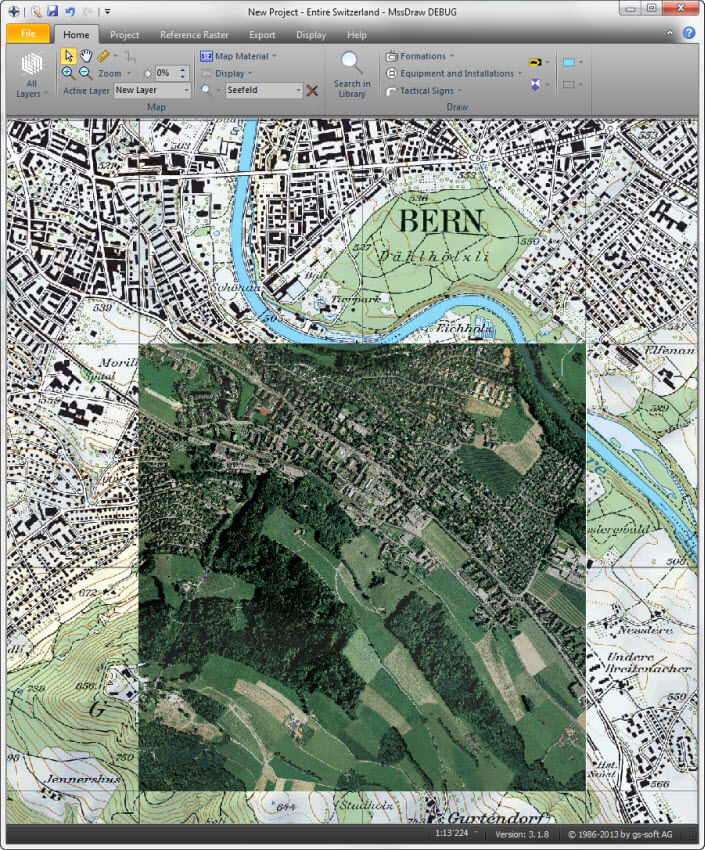
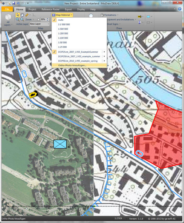
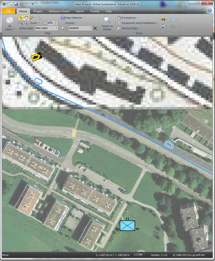
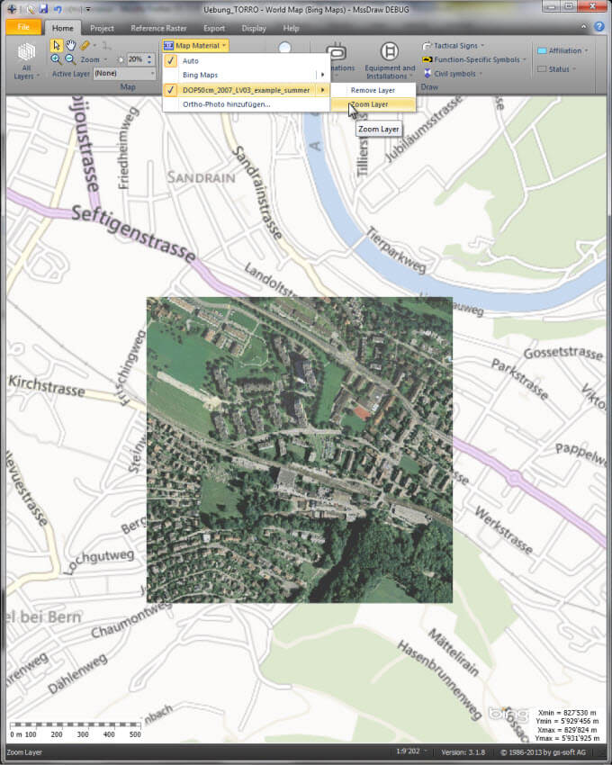
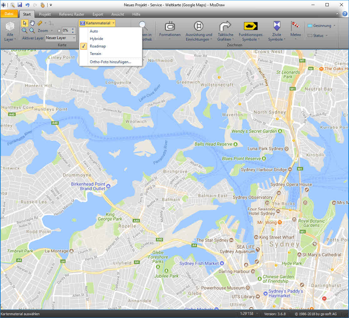
Today it is easy to start a drone to take aerial photographs. This valuable reconnaissance information can now be added into the MssDraw application. Aerial photographs with a geo reference can be added as a map overlay with the help of the "Ortho-Photo Integration…" wizard.

This new function is valuable in the following use cases:

  • Integration of aerial images for areas with a poor quality of maps
  • Integration of aerial images after a natural disaster
  • Integrate current aerial photographs as additional reconnaissance information
  • ...

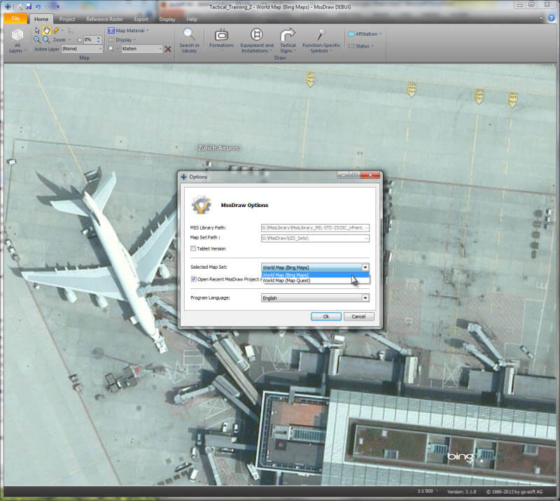
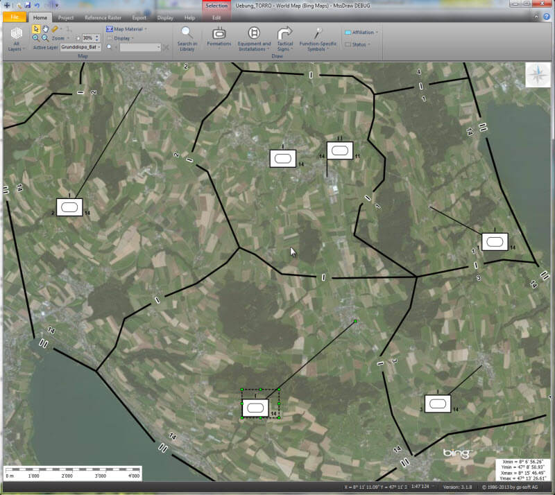
The new function is supported from MssDraw version 03.01.09 and later. On the right hand side you find some example of Ortho-Photo overlays added this way.

Export Military Map to Tablets or Phones

Over the past months we have focused on the export of military map overlays to mobile devices. This function is part of the next version of MssDraw. The new export to mobile devices creates a file structure that can be loaded on common mobile operating systems without installing additional apps or services. The photos on the right show such exports loaded on supported devices…

Military Map Export on Android Mobile Phone
Military Map Export on iPhone
Military Map Export on Windows Phone
Military Map Export on Windows Tablet

MssDraw - Improvement of Image Export

New Function
New Export Window
Select Area

The entire image export in the MssDraw has been revised and improved. This has been done on the basis of direct user feedback. The export function supports new file formats as for example SVG. This provides the possibility to export entire military map overlays into a single SVG-File.

In addition it is possible to manually define the extent of an area, zoom level and the image resolution for every export. This is helpful in the planning phase to get a static situation overview.

Import of Custom Maps into MssDraw

On request of our international and national users we have developed a function to add custom maps into the MssDraw . This function is part of the next MssStick release. The new function allows the customer to add maps into a local storage. It supports the common formats for electronic maps and provides a fast and smooth map handling.

The Manual Addition of Local Maps

International MssStick Version

Military Symbol Galleries improved
Bing Map Service
International Military Map Overlay
Different Base Maps

In the past weeks we have focused on the development of an international MssStick version. This was due to the increasing number of international requests for MssSticks.

  • The international version of MssDraw uses the map services of Bing Map and open Street View.
  • This version of MssDraw and MssComposer is using the international MssLibrary, which covers all the tactical graphics and symbols defined in the standards MIL-STD-2525C and APP-6B.
  • The galleries are designed to provide the most frequently used tactical graphics and symbols in a user-friendly way.

Platform independent Display of Military Maps

Thanks to the improved SVG and XAML export, it is newly possible to export military map overlays from MssDraw directly to GoogleMap. As already known from the GoogleEarth export individual or multiple layers can be selected and exported. The generated file resp. file structure can be opened afterwards in any web browser. This provides the export of layers on the following devices: IPhone, IPad, android phones and tablets as well as on Windows phones and tablets.

Hence the military map overlays created with the MssStick can be exported directly to a peripheral device which can be used platform independent. More information on this new feature will follow.

Export to Google Maps - Step 1
Export to Google Maps - Step 2
Export to Google Maps - Export 1
Export to Google Maps - Export 2

XAML and SVG export from military symbol editor

In the last weeks, the XAML and SVG exports of symbols and tactical graphics out of MSS® (MSS Com Server) have been improved. XAML is a possible way to embed the MSS Com Server (MSS Symbol Generator) in a GIS system as for example into ARC GIS. The internal developments enable an optimized generation of the corresponding 1-point symbols resp. n-point tactical graphics.
Further information about the enhanced SVG-export and its platform independent use is presented in a next article.


Improvement of speed and resources-consumption in MSS, MssDraw and MssComposer

MssComposer
MssDraw
MssDraw on ASUS Vivo Tab
MssComposer on ASUS Vivo Tab

MssDraw and MssComposer ,the applications to create military map overlays as well as to manage organization-/operation-structures and state of readiness-/means-tables , have been improved step by step in the last months. The main goal was to enhance the applications speed by using less memory.
The low consumption of memory lets the applications MSS, MssDraw and MssComposer run smoothly on the hardware used in the Army or installed on military vehicles. Furthermore the applications run also without any noticeable delays on subnotebooks of the first generation or on a windows 10 tablet with ATOM processor.

NATO uses MSS

MIR GEN used to generate MIP matching - 1
MIR GEN used to generate MIP matching - 2
MIR GEN used to generate MIP matching - 3
MIR GEN used to generate MIP matching - 4
MIR GEN used to generate MIP matching - 5
MIR GEN used to generate MIP matching - 6

The NATO Military Interoperability Program (MIP or short NATO - JC3IEDM) uses MIR GEN of gs-soft. This application bases on MSS® and thereby contains all symbols and tactical graphics defined in the international standards. The participants from the various nations use MIR GEN to link military symbols and tactical graphics from the standards MIL-STD-2525C, MIL-STD-2525B, APP-6A and APP-6B with the corresponding MIP-IDs . The final product of this work is amongst others the central data base which contains the single links between MIP ID and Symbol ID (more than 300’000 single links). Additionally, MIR GEN allows creating reports directly out of the maintained data.

  • The international use of MSS shows the versatile applicability the product.
  • You can find further information about the application MIR GEN in the documentation of the application.
  • Some of the documents generated with MIR GEN can be downloaded from the NATO - JC3IEDM / MIP homepage.

Contact US

  • gs-soft AG

    Delfterstrasse 10

    CH-5000 Aarau

    Switzerland

    Phone:
    +41 62 832 20 40
    E-Mail:
    This email address is being protected from spambots. You need JavaScript enabled to view it.


  • Language